In a nutshell, St Martin is the home of mega yachts, Anguilla is like Cape Cod, Saba is a big mountain belonging to Holland, and St Kitts - Nevis is an independent country struggling to find its identity....,
All different, all with pros and cons for the potential visitor.
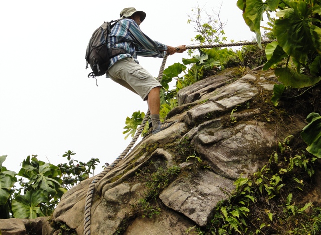
We didn't take any photos in St. Martin. We've already posted a lot of photos of white beaches, so will skip Anguilla. To visit Saba, we took a ferry from St Martin and climbed to the "highest point in the kingdom of the Netherlands." The extinct volcano rises abruptlyl 2855' from the sea, and the trail has 1064 steps, with a thick rope to grab toward the summit.


 Blair spent almost a week on Wilhelm while we were in Antigua and Barbuda. Highlights of his visit included visiting some untraveled spots in the north of Antigua and Barbuda; snorkeling in warm clear water; watching classic boats arrive for the Antigua Classic Yacht Regatta; and spending several days in Nelson’s Dockyard, English Harbour – a semi-restored area that was a center of British Naval activity in the 1700’s.


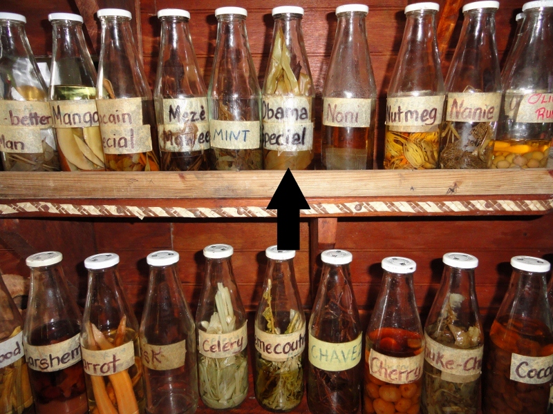
 Throughout the Caribbean we have seen our President viewed as an inspiration and symbol of hope to the people who live here - St. Kitts has an honorary stamp and Antigua has renamed its highest mountain. Many businesses have posted photos of Obama.